Moduł Roboty ziemne służy do modelowania obiektów geotechnicznych, takich jak: wykopy fundamentowe, nasypy drogowe i kolejowe, kamieniołomy, skarpy i zbocza oraz innych. Moduł ten umożliwia także wykonanie obliczenia objętości prac ziemnych i osuwisk.
Moduł Roboty ziemne stanowi rozszerzenie programu Stratygrafia 3D.
More Features
Moduł nie jest dostępny niezależnie. Wymagany jest program Stratygrafia 3D.
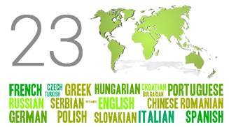
GEO5 umożliwia generowanie raportów wyjściowych w różnych językach – funkcja przydatna przy projektach zagranicznych.
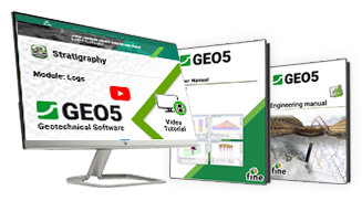
Nasze samouczki i podręczniki poprowadzą Cię sprawnie przez programy.
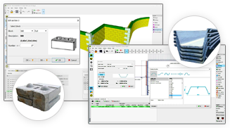
GEO5 zawiera katalogi profili, grodzic, kotew, gwoździ, geosiatek i bloków.
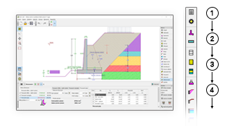
Programy GEO5 mają ujednolicone środowisko i intuicyjny sposób pracy.
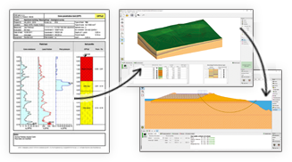
GEO5 integruje modelowanie danych geologicznych z zaawansowanymi zadaniami geotechnicznymi.
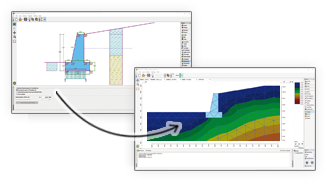
GEO5 umożliwia porównanie dwóch niezależnych rozwiązań.
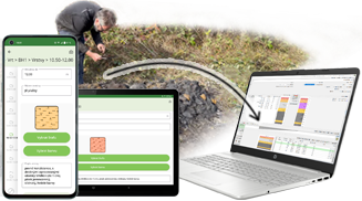
Zbieraj dane geologiczne w terenie i przesyłaj je do programu Stratygrafia 3D.
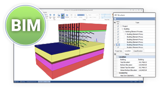
GEO5 eksportuje dane do popularnych formatów BIM i udostępnia je programom innych firm.
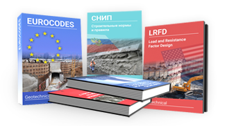
GEO5 to uniwersalne narzędzie dla inżynierów na całym świecie.
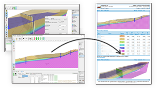
Dokumentacje wyjściowe GEO5 można łatwo edytować lub eksportować do formatów PDF i MS Word.
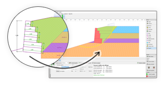
GEO5 umożliwia przesyłanie danych pomiędzy poszczególnymi programami.

GEO5 umożliwia generowanie raportów wyjściowych w różnych językach – funkcja przydatna przy projektach zagranicznych.

Nasze samouczki i podręczniki poprowadzą Cię sprawnie przez programy.

GEO5 zawiera katalogi profili, grodzic, kotew, gwoździ, geosiatek i bloków.

Programy GEO5 mają ujednolicone środowisko i intuicyjny sposób pracy.

GEO5 integruje modelowanie danych geologicznych z zaawansowanymi zadaniami geotechnicznymi.

GEO5 umożliwia porównanie dwóch niezależnych rozwiązań.

Zbieraj dane geologiczne w terenie i przesyłaj je do programu Stratygrafia 3D.

GEO5 eksportuje dane do popularnych formatów BIM i udostępnia je programom innych firm.

GEO5 to uniwersalne narzędzie dla inżynierów na całym świecie.

Dokumentacje wyjściowe GEO5 można łatwo edytować lub eksportować do formatów PDF i MS Word.

GEO5 umożliwia przesyłanie danych pomiędzy poszczególnymi programami.

GEO5 umożliwia generowanie raportów wyjściowych w różnych językach – funkcja przydatna przy projektach zagranicznych.

Nasze samouczki i podręczniki poprowadzą Cię sprawnie przez programy.

GEO5 zawiera katalogi profili, grodzic, kotew, gwoździ, geosiatek i bloków.

The software in general is very good and ties in well with the way we do things here. From our review, the calculation results compares very well with our methods for both slope stability and settlement. The graphics and the ‘point-and-click’ data input are also very good and makes the program very easy to use.

It’s really great how easy the software is. I’m now doing the calculations so much faster and easier than doing it manually and most importantly, the technical customer service team are great and they respond instantly and professionally to any question or clarification. Thank you guys for being so awesome. High fives!

Great software....highly recommend.....always updating/improving and implementing feedback from users.